Patrical
Software for the calculation of precipitation-contribution in water quality integrated network sections
Description
Characteristics
Images
Description
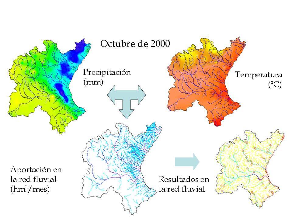
The Patrical simulation module allows to construct models of the hydrological cycle and quality of spatially distributed waters with monthly simulation time step.
The models constructed make the simulation of the hydrological cycle, in a natural regime or in a regime altered by anthropic activity, applying the formulation in each small element (eg. resolution of 1 km by 1 km) in which the watershed is discretized. The program allows to contemplate the lesser possibility of evapotranspiration of vegetation with low moisture content in the soil, lateral transfers between aquifers, water movement through river networks, river-aquifer relations (including the possibility of losses in channels) and the evolution of the average piezometry of aquifers.
Characteristics
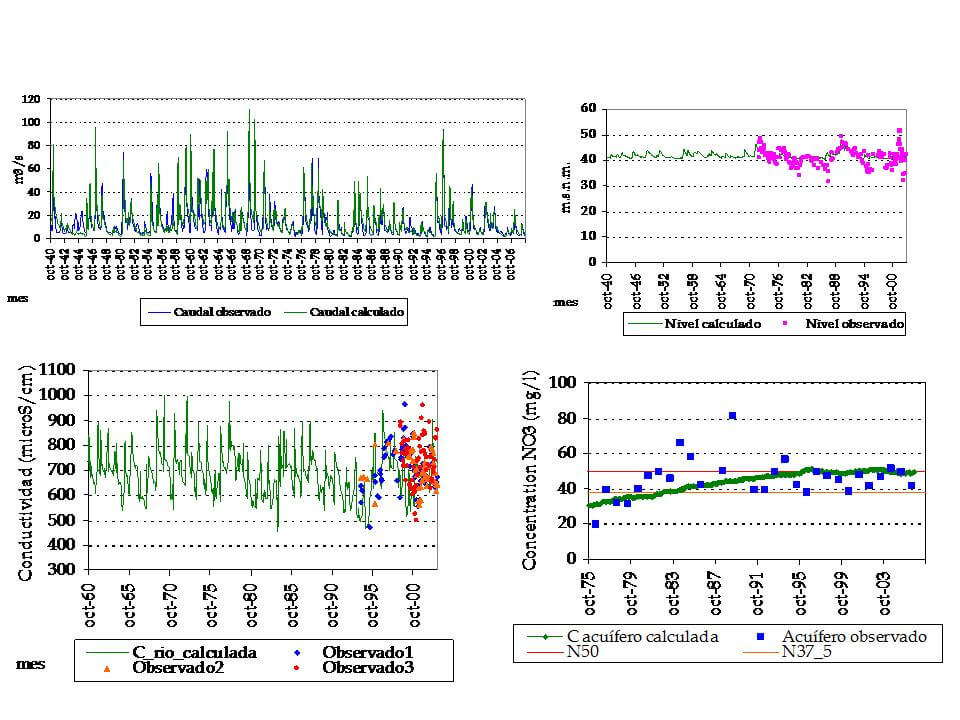
The simulation of water quality includes: the transport of nitrogen in its mobilizable form “nitrate”, the generation of erosion and transport of solids, the transport of phosphorus and the electrical conductivity of water at 25°C. For these parameters, both pollution sources and point sources are considered as the diffused ones.
The rain-runoff model uses historical records of monthly total rainfall and historical records of average daily temperatures of the month, thanks to which, through interpolation it is possible to obtain distributed monthly rainfall maps and distributed monthly average temperatures. These records are introduced as data in the simulation model to reproduce the hydrological cycle, which obtain as results the contributions of the fluvial network and the evolution of aquifers. In the case of the fluvial network, the model obtains: the maps of contribution generated in each point of the watershed, the losses in channels and the contributions in each point of the fluvial network. Meanwhile for each aquifer, the model obtains: the average piezometric levels, the volume of water stored and transferred to other aquifers and the direct exit to the sea.
The simulation model allows to know the flows, storage of water and concentrations of chemical substances that are produced in the watershed, both in natural regime and in altered regime.
The water quality results obtained with the simulation model have the following utilities:
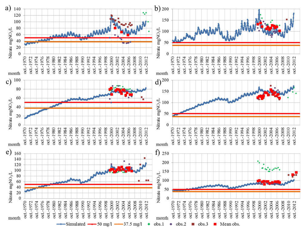
- To know the chemical status of the ground and surface water bodies of the modeled parameters, nitrates, phosphorus, electrical conductivity of the water and suspended solids, as well as of all water bodies in the watershed, having historical data sampled or not, and in this way to detect areas with elevated values or normal values.
- To clarify which are the causative agents, or the origin, of the chemical state of the bodies of water.
- To know the historical evolution of the different chemical parameters modeled, detecting zones with tendency to have higher or lower concentrations of these substances.
- To propose corrective measures to improve chemical status, and quantitatively evaluate the effectiveness of such measures.
- To obtain historical series of flows and different quality parameters.
To know the background levels, eg. the concentration of chemicals in the watershed of natural origin.
Images